Wednesday, August 29, 2012

Sample Photos

Judy Dropped Me Off At The Start Of The HST
 
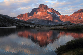
Hamilton Lake

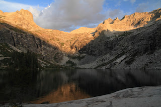
Precipice Lake

Kern River

Looking West From Trail Crest

Rock Formations From Summit Of Mt. Whitney

Mt. Whitney From Timberline Lake

Forester Pass From The South

Looking North From Forester Pass

Bullfrog Lake Reflections

Mt. Brewer

Early Morning Light In Route To Pinchot Pass

Upper Basin From Mather Pass

View West From Mather Pass

Palisade Group From Mather Pass

Lower Palisade Lake

The Black Giant & Le Conte Canyon

Looking North From Muir Pass

Wanda Lake

I Think This Is The Moon

Sunset From Mc Clure Meadow

Lake Of The Lone Indian

The Silver Divide

My Camp At Thousand Island Lake

Banner Peak

Closer View Of Banner Peak

Early Morning Light On Summit Of Half Dome

Myself On Summit Of Half Dome


Daily Mileages

Here is a list of my daily mileage. Full trip report coming slowly..........

Day 1=Crescent Meadow To Hamilton Lake, 15.5 Miles, +3300'

Day 2=To Kern Hot Springs, 21.3 Miles, +4100'

Day 3=To Crabtree Meadow, 16.4 Miles, +4300'

Day 4=To Mt. Whitney, 15.4 Miles, +4200'

Day 5=To Center Basin, 18.9 Miles, +4000'

Day 6=To Onion Valley Trailhead, 12.2 Miles, +2300'


Segment 1=103.2 Miles, +22,700'


Day 7=Zero Day In Bishop

Day 8=Onion Valley To Woods Creek, 18.6 Miles, +3900'

Day 9=To Upper Basin, 14.6 Miles, +4700'

Day 10=To Le Conte Canyon, 17.4 Miles, +2100'

Day 11=To McClure Meadow, 17.8 Miles, +3600'

Day 12=To Sallie Keys Lake, 17.9 Miles, +2800'

Day 13=To VVR, 17.7 Miles, +1900'


Segment 2=107.2 Miles, +19,000'


Day 14=To Lake Virginia, 17.6 Miles, +5000'

Day 15=Reds Meadow, 16.1 Miles, +1300'

Day 16=To Thousand Island Lake, 15.7 Miles, +2800'

Day 17=To Tuolomne Meadows, 21.2 Miles, +2300'

Day 18=To Clouds Rest Junction, 18.8 Miles, +2100'

Day 19=To Curry Village via Half Dome, 12.0 Miles, +2000'


Segment 3=101.4 Miles, +15,500'


Total=312.0 Miles, +57,200'

Photo Links

A bunch of photos are now up at Smugmug and a whole lot more will be added. Here are the addresses: They are in three segments and I put all the topo maps and profiles in their own gallery.


http://calicokat.smugmug.com/Hiking/Sierra-Nevada/HSTJMT-Segment-1-August-2012/24938061_GQLsM2#!i=2043294834&k=5FrRc7L

http://calicokat.smugmug.com/Hiking/Sierra-Nevada/HSTJMT-Segment-2-August-2012/24938096_fQPcmn#!i=2043092188&k=WNwmn4r

http://calicokat.smugmug.com/Hiking/Sierra-Nevada/HSTJMT-Segment-3-August-2012/24938133_Kkn5RM#!i=2043597062&k=PbqnGkb

http://calicokat.smugmug.com/Hiking/Sierra-Nevada/HSTJMT-Topo-Maps/24947094_hZsqVS#!i=2043699580&k=FVCXwRk

Wednesday, August 22, 2012

Mission Complete

I did it. 312.0 miles and 57,600' of elevation gain later :). It took 18 days to complete. I am so relieved to be home after the epic trek in the Sierra Nevada. Thunderstorms ruled for 15 of those days including a couple of epic displays. My time at Sallie Keys Lake and Thousand Island Lake will forever be vividly remembered. I will add some sample photos and the complete daily report soon.....

Friday, July 27, 2012

Spot Page & Bucket Send Off

The journey begins next Friday at 0700. You can follow along at: http://share.findmespot.com/shared/faces/viewspots.jsp?glId=0NaOFNhTbA984ca9UpXcPDTBLyVnieIR2

I sent my re-supply bucket to Vermillion Valley Ranch yesterday. I will be re-united with it on August 15th.

Food Organized By Day Waiting To Go Into The Bucket

Updated Itinerary

News has come that the ferry servicing the Vermillion Valley Resort has closed for the season due to low water in the lake. This will add five miles of hiking each way so I revised my itinerary to facilitate this extra walking. This new itinerary allows me an extra day if the weather should dictate.
 
Day One, 08/03:  To Hamilton Lake, 17.0 Miles, +2900'
 
Day Two, 08/04:  To Kern Hot Springs,  21.2 Miles, +3800' (Kaweah Gap)
 
Day Three, 08/05: To Crabtree Meadow (Camp 12.15), 16.3 Miles, +5000'
 
Day Four, 08/06:  To Mt. Whitney-Crabtree Meadow, 15.0 Miles, +4000' (Mt. Whitney)
 
Day Five, 08/07:  To Camp 11.19, 3.0 Miles North Of Forester Pass @ 11,230', 15.5 Miles, +3000' (Forester Pass)
 
Day Six, 08/08:  To Onion Valley, 13.8 Miles, +2300' (Kearsarge Pass) 
 
Segment Total=98.8 Miles, +21,000'. 5 Nights/6 Days
 
Day Eight, 08/10: To Dollar Lake, 14.7 Miles, +4200'
 
Day Nine, 08/11: To Camp 9.02 (2.6 Miles South Of Mather Pass), 16.9 Miles, +4300'
 
Day Ten, 08/12: To Le Conte Canyon RS, 16.1 Miles, +1500'
 
Day Eleven, 08/13: To McClure Meadow RS via Black Giant (3.0 Miles, +1600'), 20.4 Miles, +4700'
 
Day Twelve, 08/14: To Sallie Keys Lake, 16.4 Miles, +2500'
 
Day Thirteen, 08/15: To VVR via Mono Creek,=21.8 Miles, +2200' To VVR via Bear Ridge Trail=18.5 Miles, +2200'
 
Segment Total=103.0 Miles, +19,400'. 5 Nights/6 Days
 
Day Fourteen, 08/16: To Lake Virginia, 20.8 Miles, +5100'
 
Day Fifteen, 08/17:    To Reds Meadow, 16.3 Miles, +1200'
 
Day Sixteen, 08/18: To Thousand Island Lake, 17.2 Miles, +4000'
 
Day Seventeen, 08/19:  To Tuolomne Meadow, 19.2 Miles, +2200' (Island Pass, Donahue Pass)
 
Day Eighteen, 08/20:  To Clouds Rest Junction (Camp 1.02) 16.7 Miles, +2000'
 
Day Nineteen, 08/21:     To Clouds Rest-To Half Dome To Happy Isles, 17.1 Miles, +4700' (Clouds Rest & Half Dome) 
 
Segment Total=107.3 Miles, +19,200'. 5 Nights/6 Days.
 
Trip Total=309.1 Miles, +59,600'

Friday, June 29, 2012

30 Days To Go.....

Its getting to be that time. I have purchased nearly all my food for the trip, just have to get some Costco Trail Mix and M&M's and I am set. The harder part is re-packaging all the food, sorting it out by date, making sure I have enough calories each day. Then I can package it all neatly in my bucket to be mailed to Vermillion Valley Ranch. I am aiming for 3700 calories a day and making up any deficit at my re-supply points in Independence and VVR.

The trail conditions are going to be the polar opposite of last years conditions. The trail was covered in snow making navigation a hazard and the creek crossings were borderline epic. This year all is dry and well. Looking forward to seeing the difference.

Tuesday, March 13, 2012

Trip Itinerary

With the permit approved I now have an itinerary. It will be a three part trip (at least in my mind). First segment is the High Sierra Trail and up and over to Onion Valley for my resupply. Onion Valley to Vermillion Valley Resort for another resupply then VVR to Happy Isles to complete the three hundred miler.

If I learned anything about plans on last years John Muir Trail, its that an itinerary is nice to have, but flexibility is paramount to success. About the only things that were as originally planned were the start and finish date. Everything else inbetween was made up as I went along. Mother Nature created my itinerary the moment I stepped on the JMT.

So with that, here is the plan...........(the camp numbers are from Elizabeth Wenk's JMT guide).

Day One, 08/03:          To Hamilton Lake, 17.0 Miles, +2900'
Day Two, 08/04:          To Kern Hot Springs,  21.2 Miles, +3800' (Kaweah Gap)
Day Three, 08/05:       To Crabtree Meadow (Camp 12.15), 16.3 Miles, +5000'
Day Four, 08/06:          To Mt. Whitney-Crabtree Meadow, 15.0 Miles, +4000' (Mt. Whitney)
Day Five, 08/07:          To Camp 11.19, 3.0 Miles North Of Forester Pass @ 11,230', 15.5 Miles, +3000' (Forester Pass)
Day Six, 08/08:             To Onion Valley, 13.8 Miles, +2300' (Kearsarge Pass) 
Segment Total=98.8 Miles, +21,000'. 5 Nights/6 Days
Day Seven, 08/09:      Independence, Zero Day
Day Eight, 08/10:         To Camp 11.01, 0.4 Miles South Of Glen Pass. 9.4 Miles, +3,440' (Kearsarge Pass)
Day Nine, 08/11:          To Camp 10.01,1.5 Miles South Of Pinchot Pass, 14.8 Miles, +3000' (Glen Pass)
Day Ten, 08/12:           To Palisade Lakes (Camp 8.29), 15.0 Miles, +3000' (Pinchot Pass & Mather Pass)
Day Eleven, 08/13:     To Camp 8.01, 3.1 Miles South Of Muir Pass, 16.3 Miles, +2800'
Day Twelve, 08/14:    To Camp 7.16, Goddard Creek Bridge Junction, 16.8 Miles, +1200' (Muir Pass)
Day Thirteen, 08/15:  To Rosemarie Meadow (Camp 6.16), 16.3 Miles, +3000' (Selden Pass)
Day Fourteen, 08/16: To Vermilion Resort, 12.6 Miles, +1500'
Segment Total=101.5 Miles, +19,000'. 6 Nights/7 Days
Day Fifteen, 08/17:     To Lake Virginia, 14.8 Miles, +4500' (Silver Pass....10:00 am Start From VVR)
Day Sixteen, 08/18:    To Reds Meadow, 16.3 Miles, +1200'
Day Seventeen, 08/19: To Thousand Island Lake, 17.2 Miles, +4000'
Day Eighteen, 08/20:  To Tuolomne Meadow, 19.2 Miles, +2200' (Island Pass, Donahue Pass)
Day Nineteen, 08/21:  To Clouds Rest Junction (Camp 1.02) 16.7 Miles, +2000'
Day Twenty, 08/22:     To Clouds Rest-To Half Dome To Happy Isles, 17.1 Miles, +4700' (Clouds Rest & Half Dome) 
Segment Total=101.3 Miles, +18,600'. 5 Nights/6 Days.
Trip Totals=302.0 Miles, +58,600'. 16 Nights/19 Days

Backpacking Permit & Camping Permit Approved

This years permit was much easier to obtain than last years. Starting in Seqouia National Park has its advantages over the Yosemite permit nightmare. I faxed in the permit Thursday March 1st and was approved almost immediately. Last year it took five tries to get one approved.

I will be starting at the Crescent Meadow Trailhead Friday August 3rd with a finish at Happy Isles on Wednesday August 22nd.

I was able to reserve a campsite at Lodgepole for two nights with ease compared to the Yosemite Campground nightmare.

Trip Itinerary Coming.........

Sunday, January 1, 2012

Happy New Year, Here Is The Plan......

I completed the John Muir Trail last August.....(  http://calicokat-johnmuirtrail2011.blogspot.com/  ) .....and have decided I need more. I have previously backpacked the High Sierra Trail ( http://calicokat.smugmug.com/Hiking/Sierra-Nevada/High-Sierra-Trail-August-2010/13364740_9dnb39#1183662138_DsJkz  ) and have come up with the idea to combine the two treks into one monster trek. If all goes well, I will start from Crescent Meadows on August 3rd and finish in Happy Isles on August 22nd.

The focus now is to secure a permit which isn't always easy. I will post updates and itinerarys as the months go on. Thanks for following me along the preparations for the epic journey........