Wednesday, August 29, 2012

Sample Photos

Judy Dropped Me Off At The Start Of The HST
 
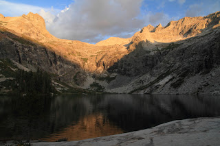
Hamilton Lake

Precipice Lake

Kern River

Looking West From Trail Crest

Rock Formations From Summit Of Mt. Whitney

Mt. Whitney From Timberline Lake

Forester Pass From The South

Looking North From Forester Pass

Bullfrog Lake Reflections

Mt. Brewer

Early Morning Light In Route To Pinchot Pass

Upper Basin From Mather Pass

View West From Mather Pass

Palisade Group From Mather Pass

Lower Palisade Lake

The Black Giant & Le Conte Canyon

Looking North From Muir Pass

Wanda Lake

I Think This Is The Moon

Sunset From Mc Clure Meadow

Lake Of The Lone Indian

The Silver Divide

My Camp At Thousand Island Lake

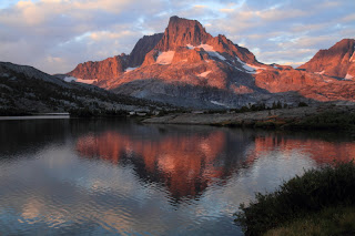
Banner Peak

Closer View Of Banner Peak

Early Morning Light On Summit Of Half Dome

Myself On Summit Of Half Dome


Daily Mileages

Here is a list of my daily mileage. Full trip report coming slowly..........

Day 1=Crescent Meadow To Hamilton Lake, 15.5 Miles, +3300'

Day 2=To Kern Hot Springs, 21.3 Miles, +4100'

Day 3=To Crabtree Meadow, 16.4 Miles, +4300'

Day 4=To Mt. Whitney, 15.4 Miles, +4200'

Day 5=To Center Basin, 18.9 Miles, +4000'

Day 6=To Onion Valley Trailhead, 12.2 Miles, +2300'


Segment 1=103.2 Miles, +22,700'


Day 7=Zero Day In Bishop

Day 8=Onion Valley To Woods Creek, 18.6 Miles, +3900'

Day 9=To Upper Basin, 14.6 Miles, +4700'

Day 10=To Le Conte Canyon, 17.4 Miles, +2100'

Day 11=To McClure Meadow, 17.8 Miles, +3600'

Day 12=To Sallie Keys Lake, 17.9 Miles, +2800'

Day 13=To VVR, 17.7 Miles, +1900'


Segment 2=107.2 Miles, +19,000'


Day 14=To Lake Virginia, 17.6 Miles, +5000'

Day 15=Reds Meadow, 16.1 Miles, +1300'

Day 16=To Thousand Island Lake, 15.7 Miles, +2800'

Day 17=To Tuolomne Meadows, 21.2 Miles, +2300'

Day 18=To Clouds Rest Junction, 18.8 Miles, +2100'

Day 19=To Curry Village via Half Dome, 12.0 Miles, +2000'


Segment 3=101.4 Miles, +15,500'


Total=312.0 Miles, +57,200'

Photo Links

A bunch of photos are now up at Smugmug and a whole lot more will be added. Here are the addresses: They are in three segments and I put all the topo maps and profiles in their own gallery.


http://calicokat.smugmug.com/Hiking/Sierra-Nevada/HSTJMT-Segment-1-August-2012/24938061_GQLsM2#!i=2043294834&k=5FrRc7L

http://calicokat.smugmug.com/Hiking/Sierra-Nevada/HSTJMT-Segment-2-August-2012/24938096_fQPcmn#!i=2043092188&k=WNwmn4r

http://calicokat.smugmug.com/Hiking/Sierra-Nevada/HSTJMT-Segment-3-August-2012/24938133_Kkn5RM#!i=2043597062&k=PbqnGkb

http://calicokat.smugmug.com/Hiking/Sierra-Nevada/HSTJMT-Topo-Maps/24947094_hZsqVS#!i=2043699580&k=FVCXwRk

Wednesday, August 22, 2012

Mission Complete

I did it. 312.0 miles and 57,600' of elevation gain later :). It took 18 days to complete. I am so relieved to be home after the epic trek in the Sierra Nevada. Thunderstorms ruled for 15 of those days including a couple of epic displays. My time at Sallie Keys Lake and Thousand Island Lake will forever be vividly remembered. I will add some sample photos and the complete daily report soon.....